Day 5:
I woke up sleepy. Donner wanted to get an early start, as usual, but at this point I was a bit resistant. We hiked along the lake and the miles went by quickly since it was mostly flat. We stopped at a bridge for a snack and chatted with kayakers paddling in the water beneath us. We passed another campsite along the lake called Lighting Creek and decided that since we hadn’t bathed in 5 or 6 days at this point, we would take advantage of our last day by the lake, and attempt to wash off. We even washed some of our clothes in the lake. For a few minutes, I actually felt clean.


A few minutes later we parted ways with Ross Lake, and started up a sneaky 500-800ft climb in the direct sun along a south facing slope. Any feeling of cleanliness left my body. The thing about the map we’re carrying is that 500-800ft climbs are hard to see on the map. Climbs that are several thousand feet are easier to see, but sometimes a 500-800ft climb over a short distance feels harder than a 3000ft climb over many miles. I had carried only the bare minimum for water since our packs were heavy from our recent resupply. John had made a snarky comment about the amount of water I had decided to leave the lake with, so I wasn’t about to tell him how dry my mouth felt. Luckily a surprise tiny stream appeared, and I was able to finish my bottle of water and fill it up again.
From Ross Lake to the PCT, we decided to trust our cumulative years of hiking experience and opt for an adventure in the form of a trail called the Castle Pass Trail, marked on various maps as either “not regularly maintained” or “unmaintained.” Some research online ahead of our trip suggested that people did in fact occasionally successfully follow this trail, so we had confidence that if anyone could do it, we could.
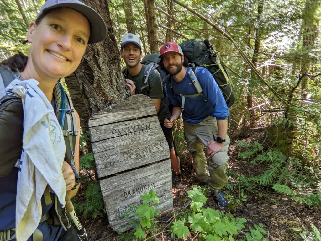
We got to the junction of the Castle Pass Trail and were pleasantly surprised to see that it was well maintained and easy to follow. We laughed at our hesitation to hike this trail and gloated at our good fortune. As we hiked, a few blowdowns appeared on the trail, but we were unfazed. We soon exited the National Park and entered the Pasayten Wilderness and found a little campsite next to a stream right before the trail headed uphill. We scarfed down our dinners and started peering into our food bags hungrily. The food would need to last another 5 days.
“There are so many snacks in here, but I can’t eat any of them! This sucks!” Donner said, voicing what each of us were silently thinking. Almost a week into our trip, and hiker hunger had finally kicked in.
We crawled into our tents hungry.
Looking at the map, I noted that the stream we were camped by was called Three Fools Creek, located just below Three Fools Mountain. Was the landscape trying to tell us something?

Day 6:
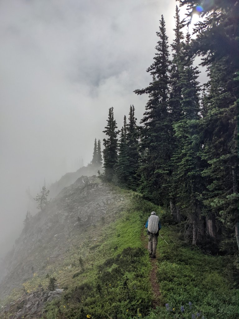
As usual, we got up early for the climb. It was a 4,000ft climb, and beyond that we had another 15 or more miles of this mysterious unmaintained trail ahead of us. The climb happened in less than 4 miles. Our calves burning from the steep trail, we were happy it was easy to follow and fairly well maintained. I was happy to see the crest of the pass, but where the trail got to the top, it kind of just petered out. We spent a few minutes admiring the landscape and pondering our next move, studying the map, and decided to simply make our own route following where we thought the trail should theoretically be. We walked along the side of the ridge – based on what the map suggested – but because the terrain was steep, and our feet were constantly at an angle along with the mountain. After a mile or two, the trail magically reappeared, and we tentatively followed it before it petered out again. Then we saw some pink flagging on a branch and walked over to it. From there we saw some more pink flagging. It was clear that someone had come through here at some point and attempted to flag the trail.
Some trampled vegetation and bear poop suggested that people may not have been the main users of this “trail.” As we got a view down into the valley we were headed into, we were only slightly surprised to see a bear right where we were supposed to be heading. We followed the flagging down where the bushes and herbaceous plants grew thicker and thicker, and eventually we realized that we were almost on top of the bear.

We shouted at it, but it didn’t even bother to look at us. Any self-respecting bear on the East Coast would have high-tailed it out of there by now, and we were shocked that this black bear had absolutely no fear. I guess hunters never came out this far. How could they? Plus, this could easily be a National Park bear, where hunting is not allowed. We inched closer to the bear, grouped up and shouted at it some more. The bear looked at us and sized us up. “Uhhh… hi bear…” I said nervously, taking a step backwards onto John’s toe. I was having second thoughts about trying to pass him. Finally, however, he pretended to be slightly more interested in a shrub a bit further away from us, and we were able to sneak past, but that was not the type of bear encounter I was used to. At least he showed no signs of aggression. Just no fear either.

Moments later, an abrupt clapping sound came out of the bushes, scaring the crap out of us. Our hearts raced. It was a grouse.
The trail sucked. It basically didn’t exist beyond the imagination of a bear. We kept rolling our ankles, wading through plants above head height unable to see our feet. Occasionally when we would see the ground there was bear poop. We were obviously walking his normal commute.
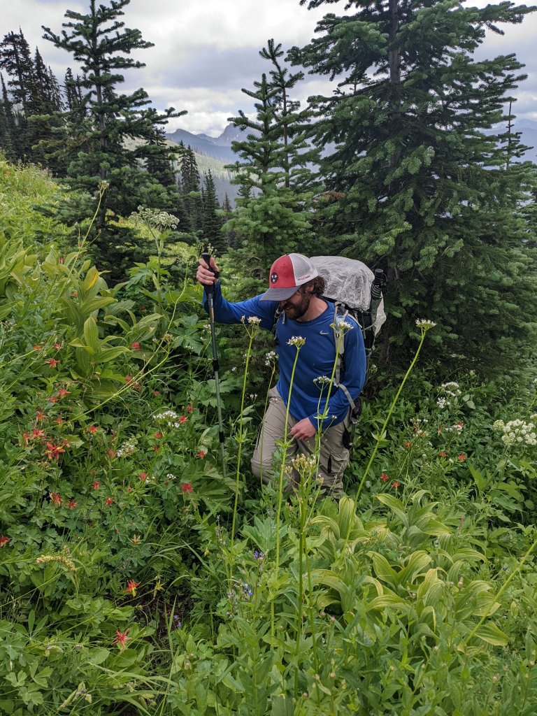
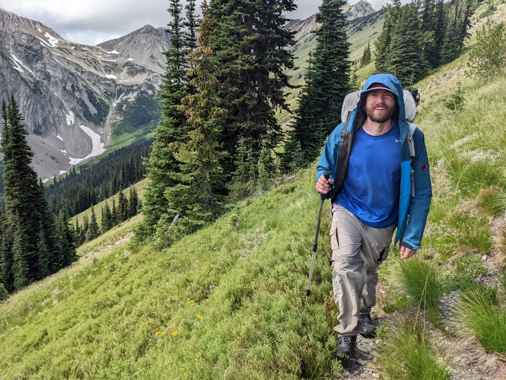
Luckily the heat wave of the last few days had ended in a somewhat drizzly day, and while the cooler weather was a welcome change, we were soaked from head to toe from plowing through wet vegetation all day. While Donner was clearly miserable, John seemed to be enjoying the adventure. Castle Pass Trail certainly had some great views and offered a level of adventure that a well-groomed trail like the PCT could never provide.

 Gorgeous mountains as far as the eye can see
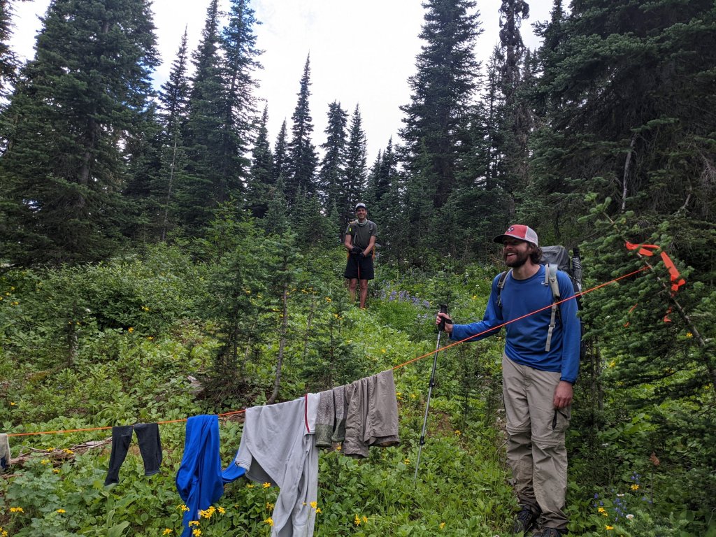
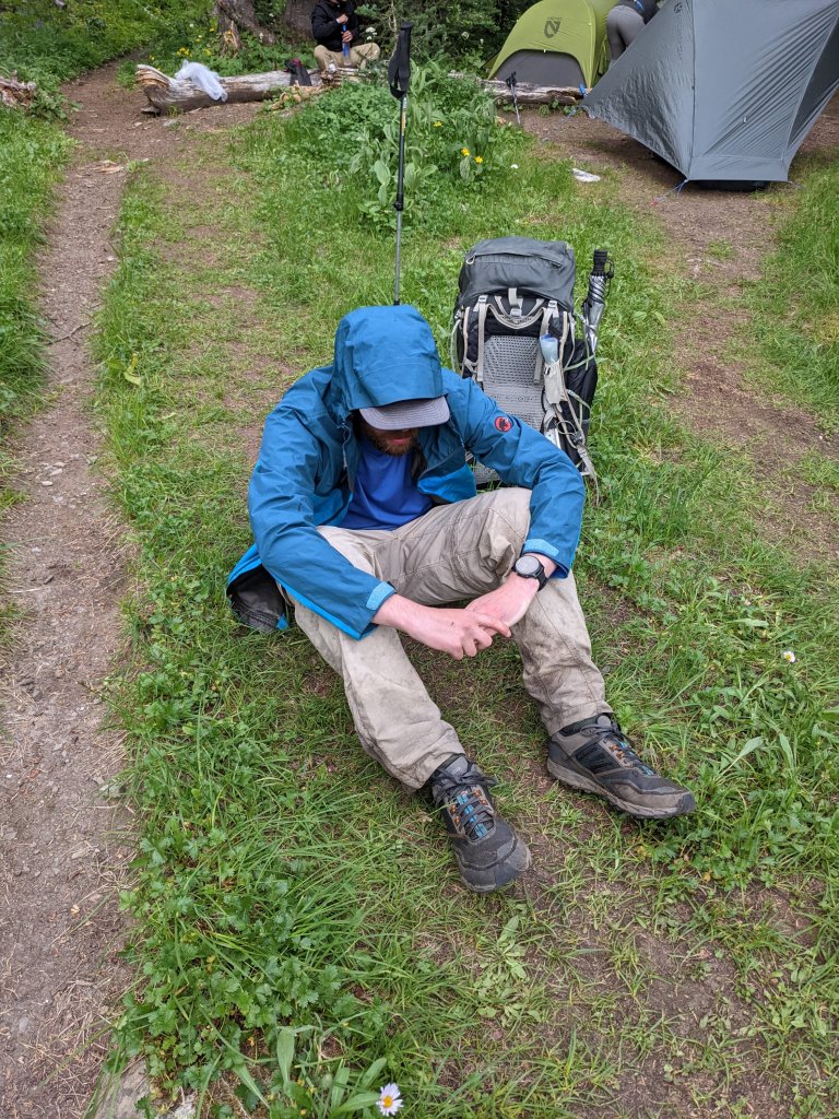
Eventually, however, we arrived wet, hungry, tired, and covered in scrapes and bruises to the PCT. Where the Castle Pass Trail intersected the PCT, someone had hung a clothesline over the Castle Pass Trail. There was barely a trail, and certainly no sign or other clue to suggest that people actually traveled this way, so it was quite amusing to have to duck under someone’s wet clothes to step foot on the PCT again. There were several people nearby swatting mosquitoes and making camp. They were oblivious to our entrance. We sat in the middle of the trail feeling sorry for ourselves. John was in a daze, and Donner had his head between his knees, and I kind of wondered if he was crying. I pulled out a snickers bar to share with my group to lift our spirits. After some debate we decided it was worth trying to push further towards the Canadian Border on the PCT since where we were was crowded and buggy.

Once we filled up on water, we could potentially camp anywhere we wanted, but in the dense Washington forest, there were no camping options. The trail was a highway. For the first time since we left Ross Lake, we could walk 3 miles an hour, and there were people every couple of minutes passing us. Quite a change from the abandoned trail we had just come from.
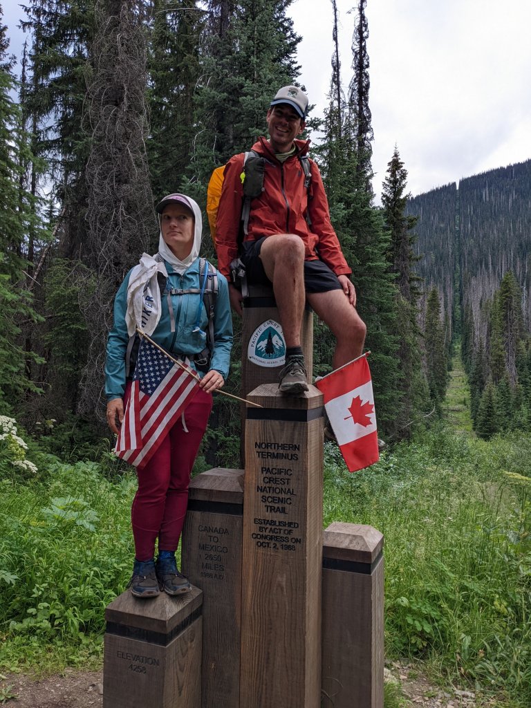
Soon we found ourselves at the Canadian border, at the PCT monument we failed to reach during our thru-hike in 2014 because the snow was too high. We spent a moment getting some pictures while swatting mosquitos. Miraculously we also found a tiny camp spot right near the border. While it was still buggy, there was nobody else there, and we could go to sleep early. The temperature quickly dropped, and I snuggled into my sleeping bag, a nice change.

Day 7:
In the morning, Donner’s thermometer read 31F. From 110F to below freezing in less than a week – crazy. We started Southbound on the PCT and passed hikers all day long. There are double as many hikers on this section of the PCT compared to any other section of the trail because every hiker here has to do an out-and-back to the Canadian border because of COVID. In previous years, you may have been able to hike into Canada and exit the trail there. That is no longer allowed, at least for now.
We bumped into a trail maintainer with a cross-cut saw and thanked him profusely for the work that he was doing. Since we were hiking in a Wilderness area, no chainsaws or other motorized equipment is allowed. They have to do all the trail maintenance the old-fashioned way. We vowed never to take a maintained trail for granted ever again, and also told him that if he had a spare month, there was a 19-mile project called the Castle Pass Trail. He told us that it had been years since they have been able to clear any trail besides the PCT. It’s too bad. If we had the time, we would have loved to volunteer.

My ankle, my hip and my shoulder all hurt. I eventually started complaining about it out loud and found out that all three of us had sore ankles, and in almost the exact same way. Something on the inside of our ankles had gotten wrecked by the Castle Pass Trail.
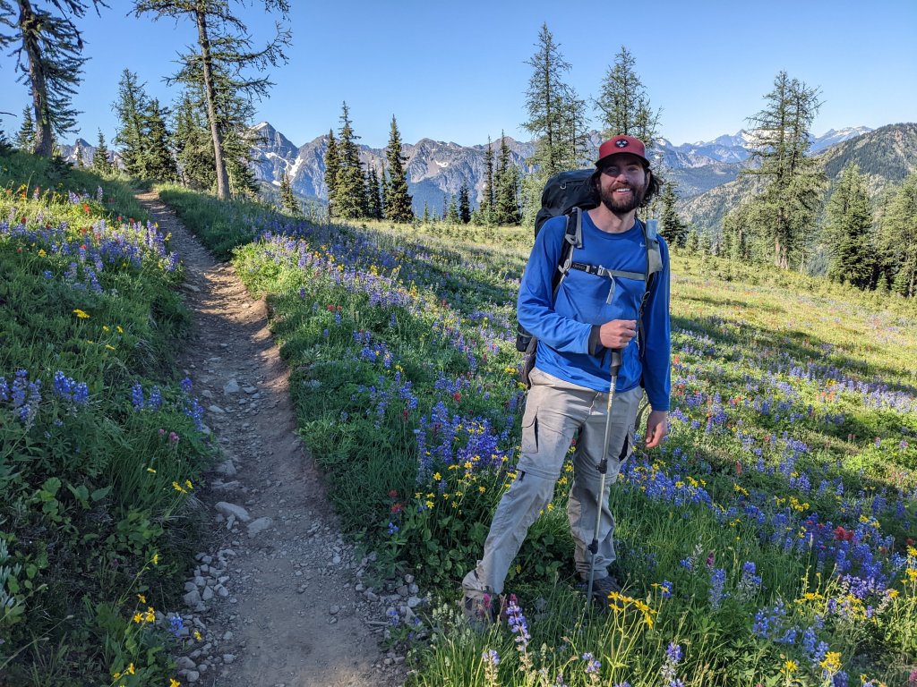
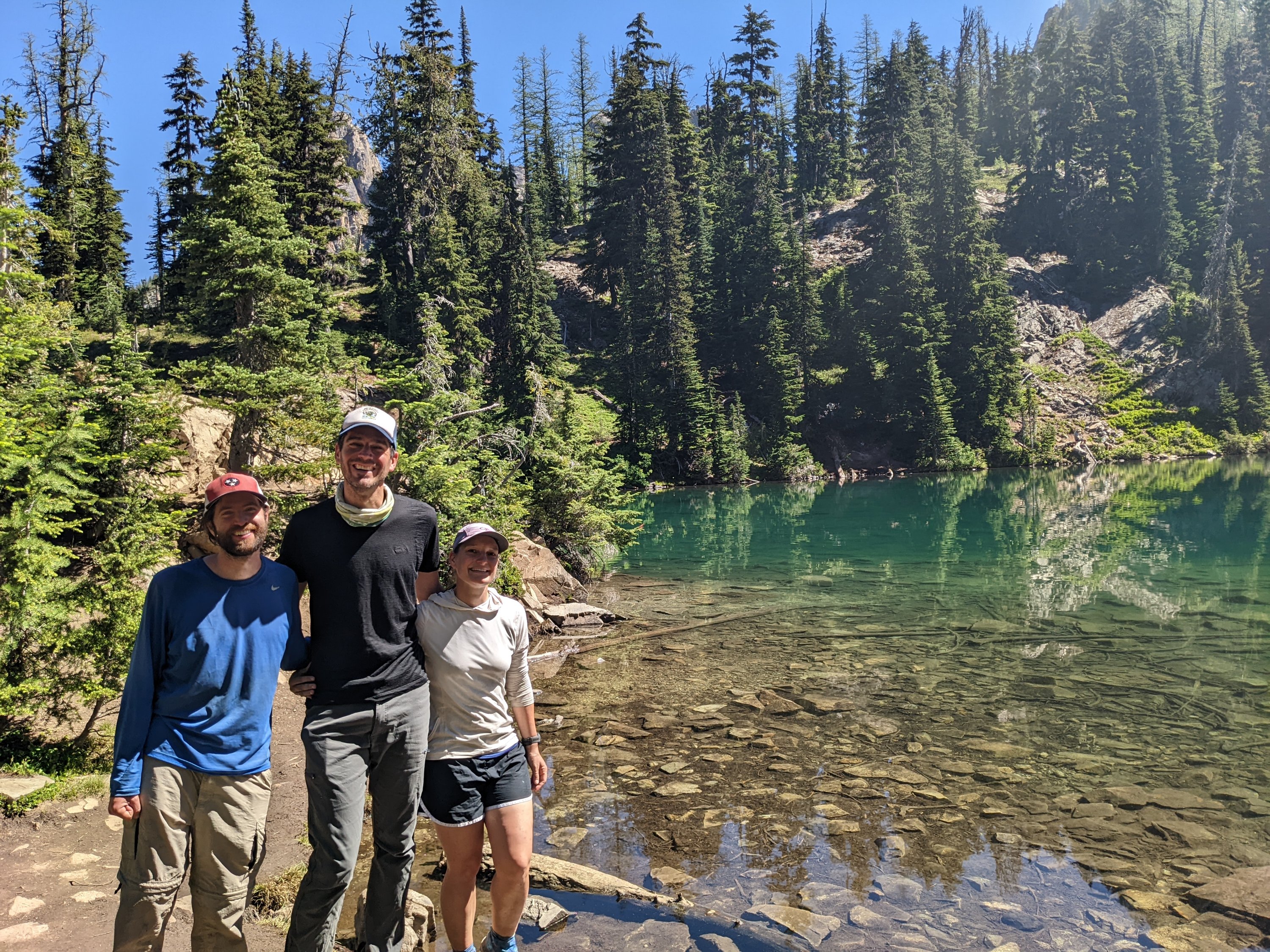
Luckily the scenery was gorgeous, and the trail was easy. We passed boulder fields and saw our adorable friends the pikas – a cute alpine rodent that looks like a chinchilla without the tail. And finally, we got a view of Three Fools Mountain, and had to get a picture of us three fools in front of it. There was something about that moment– the three of us, exhilarated by the adventure, with matching injuries, goofing off in front of these daring mountains– it was just intoxicating. This is what life is all about.

Day 8:
It was cold again at night, but the cool evening temperatures seem to ward off the mosquitoes in the early morning. By lunch time we were at Hart’s Pass and found a picnic table to eat at. We watched as Northbound thru-hikers set up shop to start hitchhiking off the trail. This was it; they were done. They seemed done. They were so excited to stop hiking. None of them seemed sad to be finished, they all seemed ready for it. The three of us looked at each other, knowingly. They had no idea.
At the end of your first thru hike, there is a huge sense of accomplishment that comes with finishing a long distance trail. But the glory wares off, and reality sets in. No more adventure. “Real life”. Work. Money. The future. It’s really hard to adjust. These innocent thru-hikers had no idea that this is the end of something magical, and they’ll miss it for the rest of their lives.
Lunch consisted of tortillas with tuna from a foil packet or peanut butter. We kept hiking and there was a long hot stretch without water. I felt nauseous. Was it the heat or the tuna? I burped about 50 times and eventually started to feel better. I think it was the tuna.
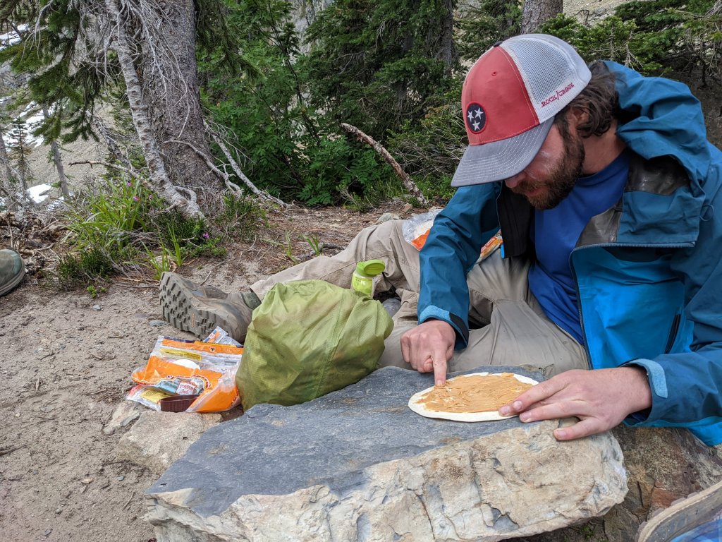
Who needs a utensil when you’ve got a perfectly good finger that hasn’t been washed in 9 days?
The trees along the ridge were mostly larches, and John was very excited, taking many pictures of them and announcing that larches were his favorite trees. I tried to imagine how many people knew what larches were. Probably not many. We hit a small patch of snow and decided to make ice packs using ziplock bags to try to help with our sore ankles. We will have matching injuries.
Day 9:
First thing in the morning, we passed a tall lanky German hiker who seemed very upset. “Is the trail overgrown all the way up the mountain?” He whined.
“No?” We all answered looking down at the trail trying to figure out what he meant. “Well, you will have an adventure for the next half mile or so.” He replied.
We wandered down the trail laughing at how spoilt PCT hikers are, and how unacceptable they find overgrown trail. In his defense, the trail was *slightly* overgrown, but nothing compared to Castle Pass, or even Park Creek Pass or Panther Creek Trail for that matter. God forbid you have to touch some vegetation.
Next up, we got talking to some German ladies (there seem to be a lot of Germans on the PCT), one of whom had blisters after walking from Hart’s Pass. They were hoping to hike all the way to Steven’s Pass (more than 120 miles south). Uli (one of the ladies) was upset that she couldn’t get any cell phone service since she could otherwise get her husband to meet her at Route 20 with her trail runners and send him home with her uncomfortable hiking boots. Donner had brought a nifty new satellite gizmo (the InReach Mini), which can send text messages by satellite for something like $0.50 per message and decided to offer her the service. We set the instrument on a rock and let it connect to the satellites while Uli tried to type a message in under 170 characters to her husband. The message sent out, and the ladies hiked ahead while we stopped to collect water and have a snack. A few minutes later a series of 4 messages came back.
“Altas?”
“Altras?
“Columbias?”
“I don’t know which ones are your trail runners”
Shoot. Each one of these messages was costing Donner, and the husband on the other end had no idea he was communicating with an expensive Satellite device and not an ordinary cell phone with infinite bandwidth. Donner sent a reply, just guessing about the shoes at this point.
“Altras, and please no replies.” Then he turned the device off.
We caught up with the ladies and verified that the shoes she wanted were indeed the Altras. We had guessed correctly. Phew.

Moments later Uli stopped and said, “We should probably collect water, I have only a liter left.”
“But there’s no water here…?” John remarked.
“We should have collected where you did, there’s never water when we want it.” Uli replied. “When we started, we carried 7 liters of water!”
I was shocked. Seven liters of water weighs 14 pounds. My whole backpack including food and water was probably only a few pounds heavier than that.
“Are you carrying a map?” I asked. She nodded.
“The blue lines on the map indicate streams, and when the trail crosses them, you will find water,” I said trying not to sound too condescending.
“It doesn’t always work out that way,” she argued.
I blinked, not really knowing what to say. Again, trying not to make her feel stupid I added, “we have found water at every stream on the map, and then there have been some small creeks that are not on the map because the snow is still melting.”
We left them to figure out their water situation, and continued hiking, gossiping about how unprepared these women were. Moments later a small creek appeared, and we knew they would be fine. Most of the PCT in Washington has plentiful water. Had they been hiking further south on the PCT, they may have been in bigger danger.

We set up camp next to Porcupine Creek with only a few miles left to get to Route 20, and as we munched on whatever was leftover in our food bags, the German ladies passed us trying to meet Uli’s husband before nightfall.
I was excited at the prospect of town. After 10 days without a shower, we were filthy. We also hadn’t had a hot meal in as many days. A burger sounded fantastic. I fell asleep imagining curling up under clean sheets in an airconditioned hotel room, having taken a long shower.
Day 10:
I woke up as excited as I fell asleep, and I powered down the hill towards the road. John and Donner were slower to get going, and for a change I was hiking ahead of them. I passed a couple out on a day hike and decided to entertain myself by sending a message back to confuse John. “Ask the really tall guy wearing shorts if he likes larches” I said to them. I explained that it would be funny.
When Donner and John caught up with me at the parking lot, I asked John if the couple asked him any questions. Donner cracked up. “They asked ME if I liked larches, and I was so confused!” he said.
“You’re not that tall, and you’re not even wearing shorts,” I laughed.
“They asked me too!” said John. “They were like ‘I hope you’re the right person to ask this question to – do you like larches?’”
“And — what did you tell them?” I asked
“I told them it was my favorite tree.” We all laughed, but I was probably the most amused.
The next task was to hitchhike into town. It was already getting warm, and there was no shade on the road. Plus, there were three of us and people driving by may not want to pick up three hitchhikers all at once. We decided to try anyway. We stuck out our thumbs and put smiles on our faces as one car passed every 20 minutes. It was hopeless. There were ten times as many cars going toward Seattle as there were going towards Winthrop, the town we were aiming for. We decided to try taking turns, letting either me and John try, or Donner by himself.
While Donner was waiting in the parking lot, a couple of hikers walked into the parking lot and started loading up their vehicle. He ran up to talk to them, and eventually waved us over. I ran over, excited that we had probably gotten a ride.
“Who’s up for another hike?” Donner said, cheerfully.
John didn’t wait for my answer, knowing how disappointed I probably was. “MEEEEE!” he shouted.
The couple were headed to Winthrop, but by way of Blue Lake, a popular 4-mile hike. It was our best shot at getting a ride to town. We hopped in.
Although I was not mentally prepared to hike another 4 miles, the destination was beautiful although a bit crowded. We even saw mountain goats along the way, who seemed less phased than I was by the number of people.

We eventually got dropped off in Winthrop, where we wandered into the hostel we booked, and I enjoyed possibly the most satisfying shower of my life. After we were all cleaned up, we wandered back into the broiling heat to find a burger at the Old School House brewery. We probably would have stayed and ordered more food after we polished off our burgers, but our outdoor table was slowly moving into full sun, and we were melting in the heat. Instead, we opted to find ice-cream somewhere else.
Everything in Winthrop was exorbitantly expensive. A single granola bar was almost $2, a single string cheese was $1, and a small jar of peanut butter was $6. I was so glad I mailed another resupply package to the hostel we stayed at.
Eventually, I got my dream of crawling into a freshly made bed with the air-conditioning cranked all the way up.
Stay tuned – more to come!

Pingback: Loop close to North Cascades Days 5-10 - Yosemite Fitness
Looks like a fantastic trip, your photos are beautiful. (Thanks for sharing) Stay safe on the trails & happy hiking!
LikeLike