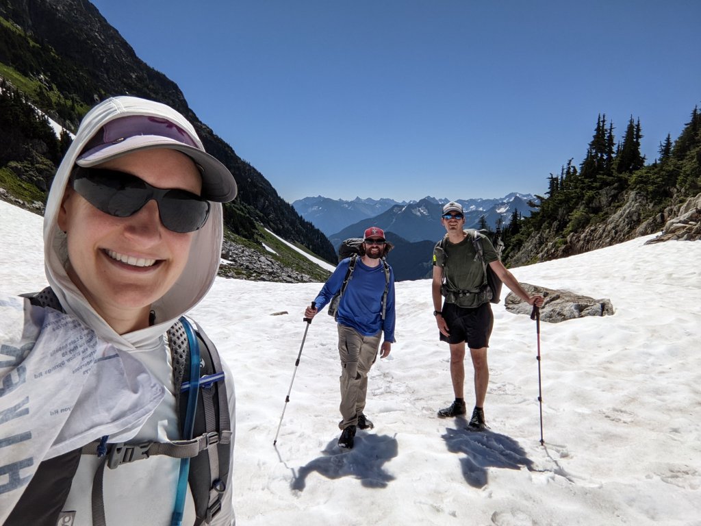
It has been MORE THAN A YEAR since we have been backpacking, which is probably an all time record. Two years of grad school followed by a cancer diagnosis and surgery left us with very little hiking and no backpacking this summer. But we’re back in the Asheville area, and have decided start a new project: the Smokies 900. The idea, if you haven’t guessed already, is to hike all the trails in the Great Smoky Mountains National Park, of which there are more than 800 miles worth. It certainly takes more than 900 miles to cover them all, as many of them need to be hiked in both directions or multiple times to get to other trails.
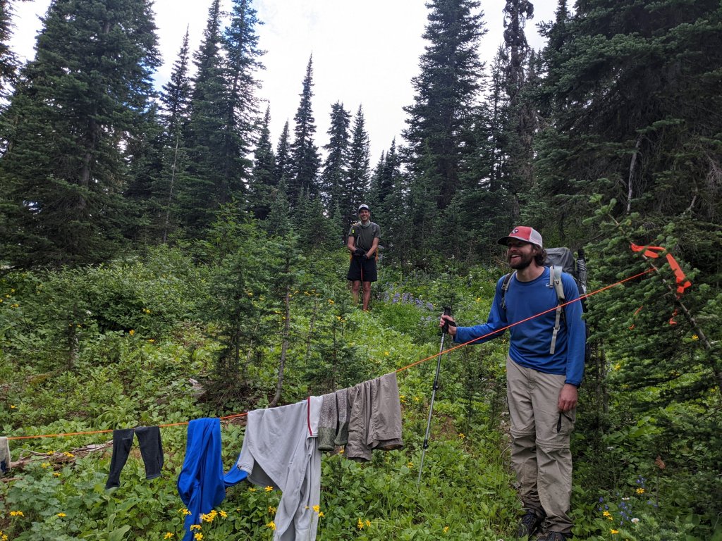
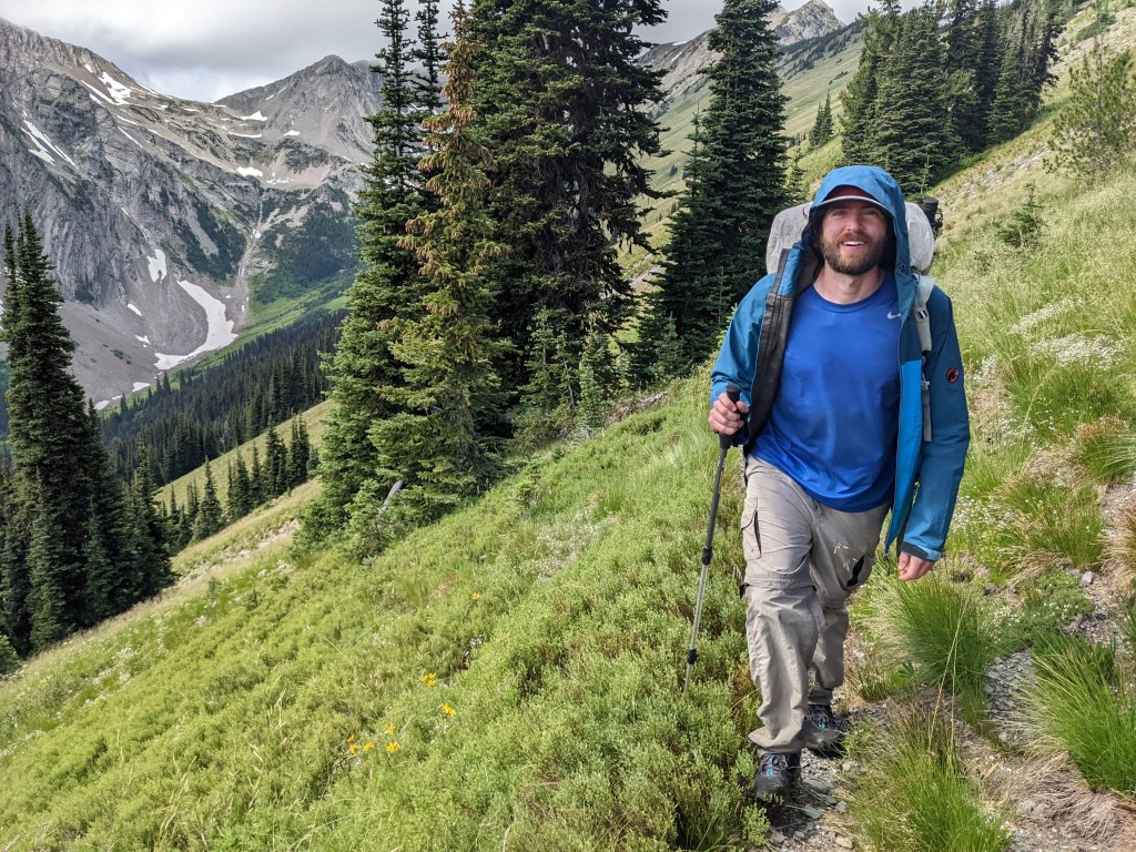
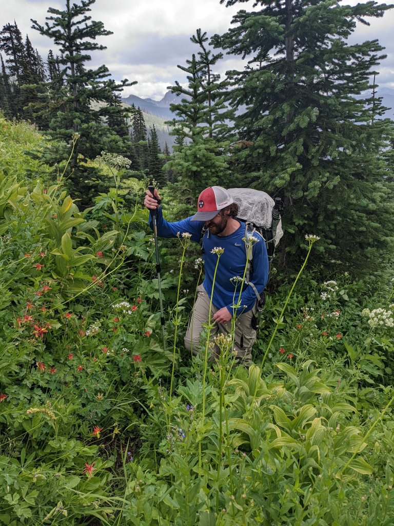
With the start of this project, we were excited to try out some new hiking pants provided to us by Kuhl! Dormouse is really enjoying her Freeflex roll-up pants (and was amazed they fit her, as usually that NEVER happens when she gets pants from online without trying them on!), and Dirt Stew (who doesn’t have trouble fitting into things) thought his new Renegade Cargo Convertable pants seemed very durable.
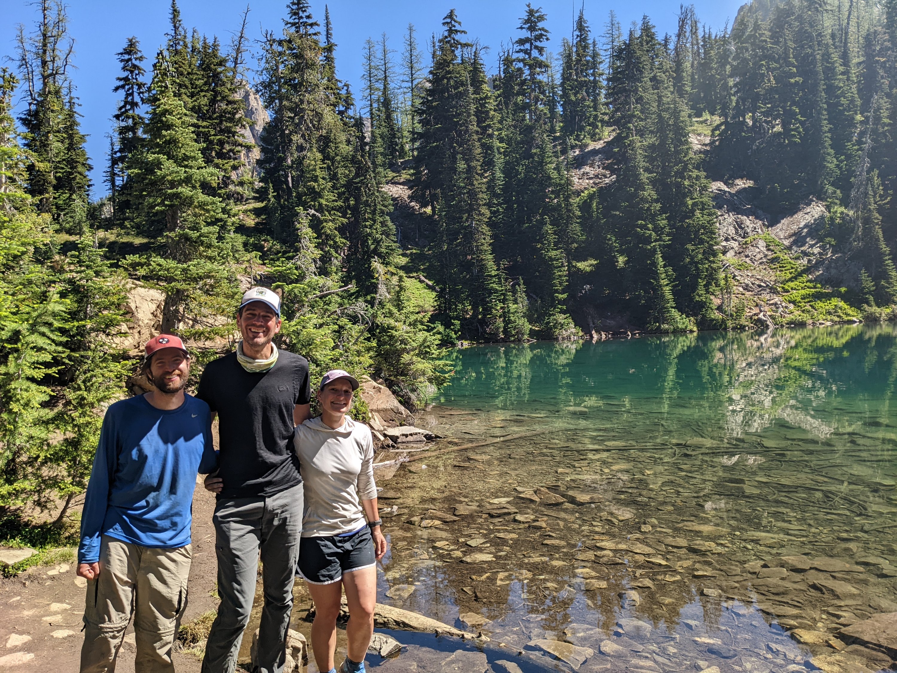
Given that it’s October and campsite reservations were scarce, I picked a somewhat random loop for us to begin this project in earnest. We invited our partner in crime, “Donner” (Rob), who in turn invited his friend “Peach” (Emily).
Day 1:
We rushed out on Friday afternoon after a full week of work to meet Donner and Peach at the trailhead at Deep Creek. We got caught in Bryson City with the train closing the road in front of us followed by construction work, making it practically impossible to get through. Finally we made it to the trailhead where Donner and Peach were waiting for us. We hoisted our backpacks on our backs and hit the busy trail at Deep Creek. We passed a yellow jacket’s nest that had been roped off. I was sort of hoping that yellow jacket season was over given that there are frost warnings for this weekend, but notice that quite a few insects are still buzzing in and out of the hole. Not a mile later, I had to do a double-take when I saw a lady pass us holding two cockatoos. I tried to take a sneaky picture, but she noticed me gawking at her and asked if I wanted to hold them. Of course I did! She kindly took my picture.
The trail morphed from a gravel road into a single track trail and the crowds disappeared. We’re making good time, especially since Dirt Stew is leading the way. “Watch out, there’s a yellow jacket’s nest right there!” he calls from the front, pointing to a big hole in a washout between some roots in the middle of the trail. “They’re calm since it’s cold – just step over it quietly” he suggested…
If you know anything about me, it’s that I always seem to get caught up with yellow jackets – and even though I tiptoed across the roots, a yellow jacket saw fit to sting me right in the butt! I let out a yelp and scurried ahead. Somehow Peach didn’t get stung, but stirred up the nest enough that Donner decided to find a way around the nest rather than trying to step over it.
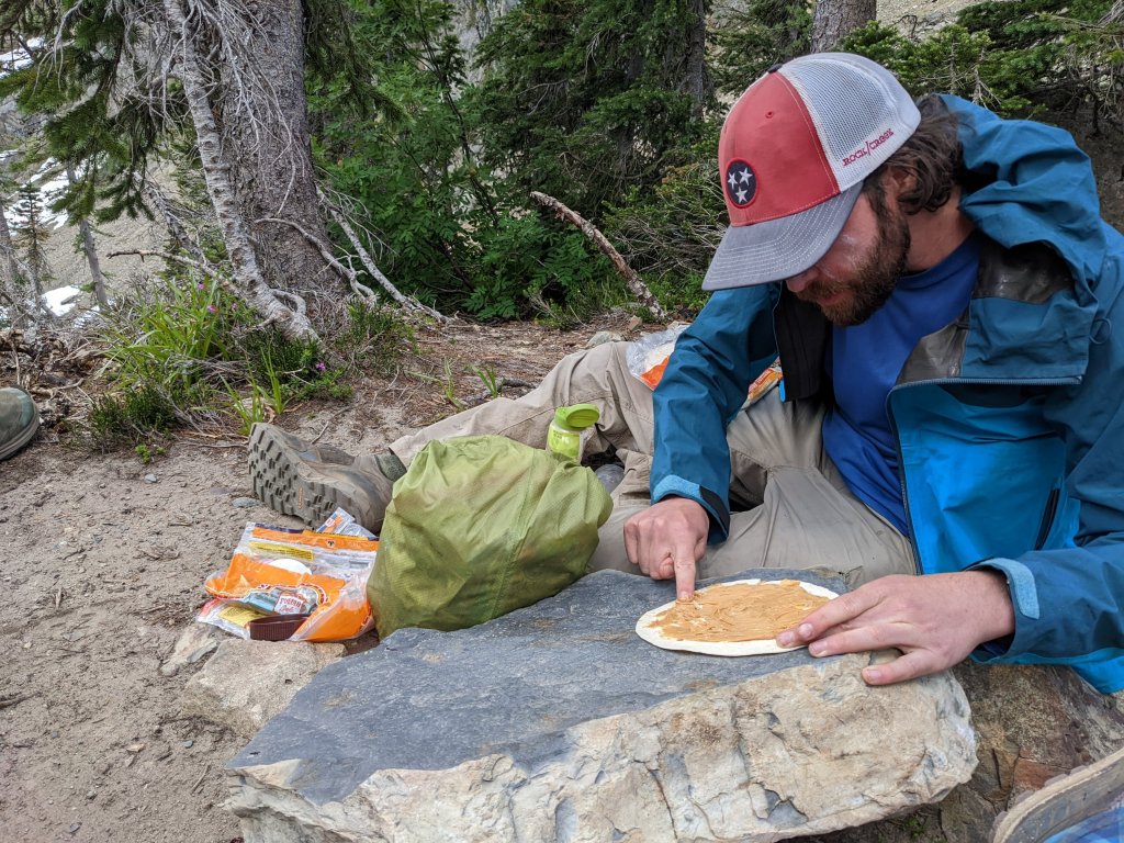
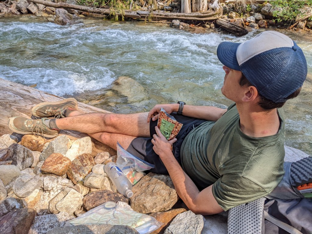
Before we make it to our campsite, we pass a log covered in chicken of the wood – a delicacy in the fungal world. Only one of us brought a stove: Peach; so we encourage her to collect a few pieces to add to her dinner.
Peach is eating noodles with chicken of the wood (an orange colored mushroom)
We make it to our stream-side campsite as darkness is falling. We decide to go looking for salamanders in the stream, and find that it is absolutely full of the adorable amphibians. Two lined salamanders alongside dusky salamanders poking their heads out from under rocks with curiosity. A light drizzle encourages us to go to finally go to bed.
Day 2:
In the morning we find out from Peach that the mushrooms had not agreed with her and she had vomited right outside her tent in the middle of the night. We all agreed that there was no way we had misidentified them, but there was a good possibility that they were not cooked thoroughly enough before she had eaten them, and that was probably the problem. Luckily Peach felt fine after she had expelled them from her system, so she had slept well after that, and was ready to hike in the morning. We all felt bad, though, for encouraging her to consume them.
The stream we camped next to was the last water source for a while, so we “cameled” (drank a bunch of water), and collected what we thought we needed to get us through most of the day. It was cold, and climbing felt good to get the blood flowing. We hit the road and decided to have lunch in a sunny patch for us to dry some of our gear (“hiker yard sale”) in while soaking up the sunshine.
We knew it would only get colder – so we took every opportunity to stop in the sun. At another sunny road crossing we found an interesting bird and investigated it while having second lunch – maybe a snipe or an american woodcock, we couldn’t tell, but it was hanging out in a grassy patch by the road, and we took turns trying to look at it. Tonight there were frost warnings for Asheville, so it definitely was freezing at the busy Keppart Shelter around 3300ft.
Day 3:
It’s very cold in the morning, so we pack up quickly and hit the trail wearing all our layers. Luckily the uphill gets our blood flowing and we slowly shed a few layers. After climbing a few thousand feet, we almost immediately descended a few thousand feet again. Amazing. We’re in the mountains. At the bottom we hit a front country campground called Smokemont. We were hoping to find a camp store or at least a vending machine because we were running low on snacks. I was fantasizing about chips… which probably meant that we didn’t pack enough salty food. Alas, no store, and no vending machine. There was a bathroom, so we took turns using it while we hung out in the grass in the sunshine. As we sat there, we looked at the three separate maps we had all brought, and tried to figure out where our next water source was. Each map was different – Donner’s showed no stream crossings all the way up to where we were going to camp at Newton Bald. Our map showed two stream crossings and Peach’s map showed no less than four. Donner decided to be bold and carry no water. The rest of us carried at least a liter.
As we climbed, Donner kept looking in each gully we passed to see if there was a water source. Time kept ticking away, and we finally passed a ravine with a tiny dribble of water. Donner, in desperation, decided to dig a hole to collect water there. The rest of us kept going, trusting in the more detailed maps. Just around the next corner there was a full fledged stream, and we laughed at the fact that Donner was probably still 5 minutes behind trying to funnel a dribble into his water bottle. He eventually caught up and decided to refill his water bottle in the stream, while making excuses about giving us the impression he had been desperate for water when he could have gone even further without it… or so he claimed. Dirt Stew and I generally it a little more safe at the expense of carrying a little more weight.
We then had to continue the climb up to Newton bald, and the trail just kept… going…. up… It was the longest day mileage-wise, and my poor legs were totally out of shape. The last few miles were a complete sufferfest (maybe just for me), and I had to remind myself of what my legs had been capable of in the past. I’ve done a 40-mile day before – in the Smokies nonetheless! I’ve done five 30-mile days in a row! How is it that a 16 or 17 mile day is absolutely KILLING me? It’s amazing what fitness you can gain or lose…
Finally we made it to the windy, freezing cold campsite near Newton Bald. I put on all my clothes and collapsed on a log hoping that someone else would do my chores for me. Luckily for me, Dirt Stew was willing to go get water from a source that required a bit of a hike down, and all I had to do was prepare a dinner of cold soaked ramen noodles. We decided to set up our tent up right next to a rhododendron bush, the only form of protection from the piercing wind.
Day 4:
We only had to hike downhill on our final day, but we had a few different trail options to get back to the car. The original plan did not have any water sources along it, and after our water adventures yesterday, we thought it was probably better to pick a route that crossed a few streams. Given how cold it was, however, we didn’t wind up drinking any of our water between breakfast and when we finished hiking. Maybe it would have been a good day to go for the dry route after all. On the route we took, we saw a couple on horses. Many of the trails in the park are open to horses (but no other pets!).
Once back at the cars, we decided to find a place to eat lunch in Bryson City. We settled on a diner since it would probably have something for everyone, but once we got to the door we found out that there was a 45 minute wait. Peach (Emily) gave her name to the host for the waiting list and we wandered around looking for any alternatives. We found an Italian place down the road, and were immediately lured in by the prospect of plates full of carbs. An hour later we emerged again, stuffed. As we walked down the road we heard the host from the diner shouting “Emily! Emily is about to go hungry!!”
We left the man shouting as we parted ways, heading home to a warm shower and a soft bed.
Exactly eight years ago now John and I reached the southern terminus of the Pacific Crest Trail. During this nearly 2600-mile journey, John carried a custom GPS unit to record, step by step, the location of the trail for a project called the “half-mile project.” Today I went into my Forest Measurements class at Duke University where I am working hard to earn my Master of Forestry degree and learned about how to collect GPS data in the field to make maps. Who would have guessed I’d be learning this stuff formally at graduate school?
In the eight years since we finished the trail, the GPS track that John and others collected along the Pacific Crest Trail in 2014 has now been used to create the official National Geographic maps of the trail from Canada to Mexico. Meanwhile, some of my writing from when we hiked is now in a book called Crossing Paths: A Pacific Crest Trailside Reader which was published to raise money for the PCTA.
After we finished the PCT, we became hiking guides and gear testers. My blog and our social media accounts received enough of a following that we have gotten sponsored on subsequent hikes, and requests from companies to try their gear. Most recently, we were contacted by Kuhl to try some of their hiking pants, which we decided was worth the effort of putting a link in our blog to receive some free gear. I never buy pants online because they never fit but was shocked when the pair that arrived actually fit me and seemed rather durable. So, if you’re interested, here’s the link. John was also impressed with the ones he ordered, so here’s the link to those too.
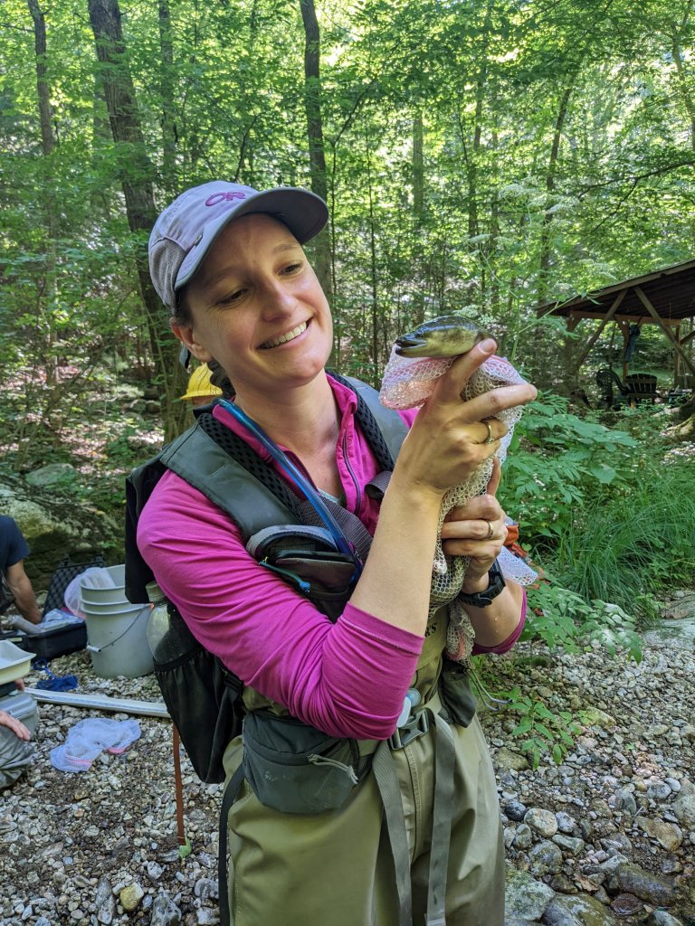
Electroshocking eels during my internship at the USFS
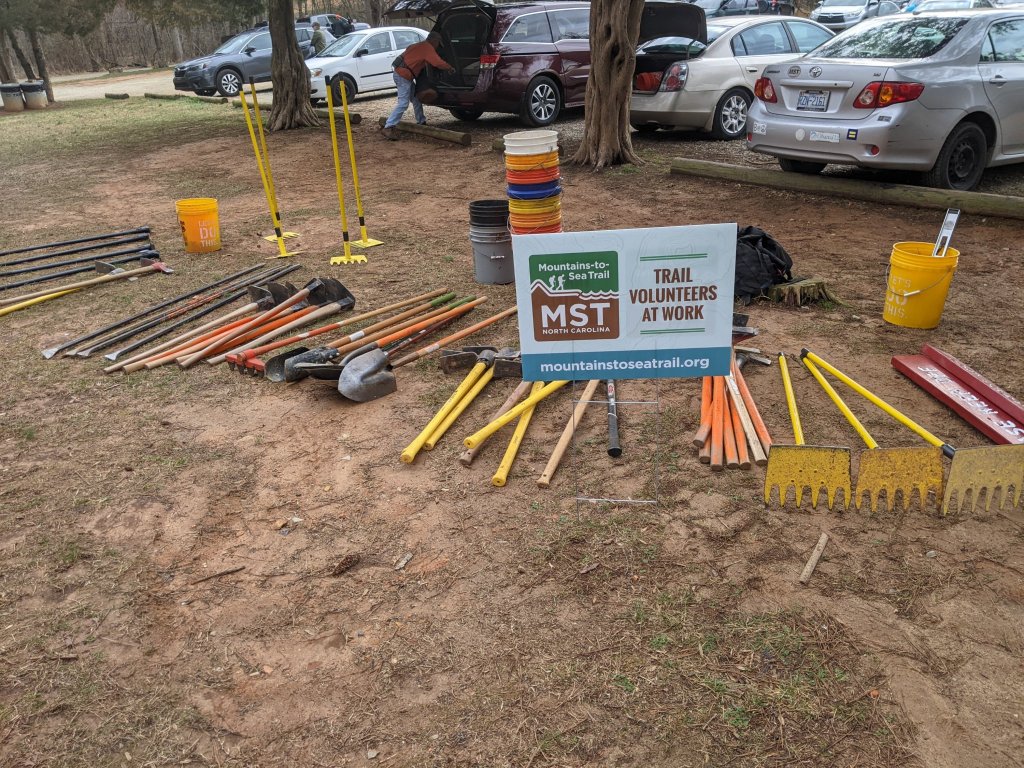
So here I am, in my new hiking pants, wishing I had them earlier since they would have been useful for the field work I did with the USFS over the summer. Graduate school is no joke, and I finally feel as though I can see the light at the end of the tunnel. I’m ready to find a job in the Asheville area when I graduate in just over half a year. During this time, John is working as an environmental consultant in Durham and is hopeful that he can bring his job back to Asheville when we move back. He is also working with local trail maintainers to help with the Mountains to Sea Trail which runs the length of North Carolina and goes through the Durham area. He has adopted a section of trail and has been volunteering on other sections of trail with local crews. Next weekend we will both become chainsaw certified (as long as the class doesn’t get rained out).
Trail maintenance on the MST
I certainly would not have guessed were we would wind up eight years after hiking the Pacific Crest Trail. Any guesses what we’ll get up to in the eight years after graduate school? I’m excited to find out!
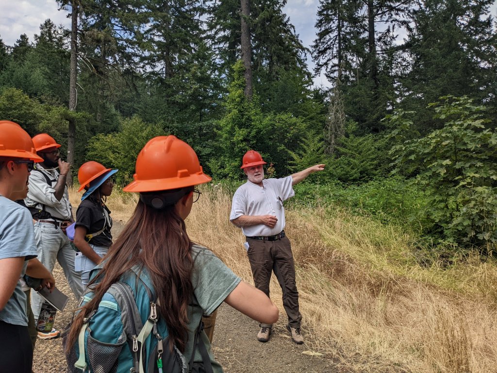
Learning forestry stuff during a field trip out west
Getting back to the trailhead was not nearly as bad as getting into town the day before. We crafted a sign with some paper and some markers that read “hikers to PCT”, and after a last-minute stop at the local bakery for some breakfast sandwiches, we got a ride in no time.
Back on trail we were hungry again within an hour, which was pretty disappointing. We still had sore ankles from the Castle Pass Trail, but out of the three of us, Donner’s ankle felt the worst. It was clear that Advil would be part of the routine for the foreseeable future. Temperatures were still warm, but the humidity was starting to creep up and I felt heat rash developing on my lower back. After a few miles, my hip starting aching. The aches and pains of long-distance hiking were catching up with us.
We saw Donner up ahead gesturing somewhat frantically towards the bushes right next to him. I tried to see what he was looking at but couldn’t see anything. Then the whole bush moved. There was a bear probably 15-20 feet away. Way too close! It had us cornered if we wanted to pass, since the vegetation was so thick, we simply couldn’t give it more space. As with the bear on the Castle Pass Trail, we tried yelling at it. No reaction. We banged our poles together. No reaction. There was no way this bear didn’t know we were there; it was only a few arms lengths out of reach. When Donner ran into it, he probably could have touched it with his trekking pole. We decided to just scamper past, grouped up together, muttering “hey bear” in its general direction. We got past. But what was it with these bears out here in Washington? Is the bear school curriculum just different out west?
As the day wore on, hunger really started to set in. I wondered if we had enough food. We were headed back into North Cascades National Park (from Forest Service and Wilderness land), and some of the campsites had bear lockers for you to store your food in. As we approached the trailhead that led to Stehekin, we examined each one for left-over food. We found a beer in one and were excited to share it. Donner found a ramen packet in another one. Near where the shuttle goes to Stehekin, there is a campsite called High Bridge with a bear-proof trash-can, and we even peered in there, just in case. We decided to spend the night there, having covered plenty of miles for the day.
High Bridge Camp
It seemed like we were going to be the only ones camping there until a lady whose trail name was “Bougie” showed up as daylight faded. We got talking to her, and it turned out that she was headed into Stehekin the next day. I asked her if she had a resupply box in Stehekin, and she said she did, but she also had a friend who was supposed to join her for the next section, and he was going to bring food too, so she was likely going to have too much. I knew this was our opportunity to try to “yogi” some food from her. Yogi-ing is the act of persuading someone to do something for you (like give you a ride) or give you something (like food) without directly asking. The term comes from Yogi Bear, a cartoon character who would often run off with people’s picnics. Now that I think about it, yogi-ing is a bit craftier than what Yogi bear does. Anyway, moments later we were in possession of whatever left over food Bougie was ready to part with.
Day 12:
We left early in the morning since we were back in a heat wave. This time the heat came with more humidity than the beginning of our journey. It was muggy, and there were lots of flies. We walked past a canyon with a river flowing through it, and into Glacier Peak Wilderness.
Amazing large trees were in the valley
Canyon with a river in it
Thanks to the extra food we scored the night before, we took two lunch breaks. We probably could have taken four.
Once it got hot, we stopped at a stream and spent a few hours entertaining ourselves by killing flies by the dozen and flicking them into the water hoping fish would eat them. We didn’t have a lot of miles to hike, so taking breaks made sense, but killing flies has its limits in terms of entertainment value, and after a while we started wondering if we’d ever make a dent in the local fly population for long enough to enjoy a few minutes in peace (the answer is no – never, they are probably hatching faster than you can kill them).
We eventually left the stream and climbed up towards Suiattle Pass. Along the way there were some thimble berries (my favorite!), and I stopped at each bush to pick the ones that were ripe. Every calorie counts! We camped near the pass at a scenic but somewhat exposed campsite near tree line. Beautiful campsites are great, but come with a certain amount of risk, and we soon saw one of the risks building in front of us in the form of thunder clouds. It was too late to move on, so all we could do was watch them grow bigger and bigger. As darkness fell, we crawled into our tent, and just as I was about to shut my eyes, the tent lit up followed shortly by an ear-piercing thunderclap! Luckily there was not much more to the storm than that, and we got a good night’s sleep.
Our camp for the night. Donner in his tent.
Camp for the night
Day 13:
We slept in a little, knowing we had very few miles to hike, and made our way towards the top of Suiattle Pass. Maybe there was a breeze and some views from the top of the pass so we could hang out there without the flies bugging us? Two people passed us, and we asked them if there was a view at the pass. “Yes!” they told us, barely stopping. We got to the pass, and it was covered in trees. No view. Why do people lie to us?
From Suiattle Pass, we parted ways with the PCT to hike towards Holden Village where we could take a ferry back to Chelan, where our adventure started almost two weeks ago. Leaving the PCT always feels nerve-wracking because the PCT is such a gentle and well-groomed trail, that any other trail feels difficult in comparison. Our trail went over Cloudy Pass, an even higher pass than Suiattle Pass, and by some miracle, this pass actually had a fantastic view and a lovely breeze! We decided to park our butts right there and eat some food. We hung out there for several hours, taking off our shoes, drying our gear, and taking pictures of the Lyman Lakes, which we had a view of. Eventually another hiker showed up and sat down with us. We traded stories for another good hour before we decided that we were probably getting sunburnt. There was a spur trail going up towards Cloudy Peak, and we decided to explore it before heading down the valley.
Lyman Lake view from Cloudy Pass
The views from the spur trail were even better than where we had been sitting before. Glacier Peak appeared in front of us along with other rugged mountain ranges.
Cloudy Peak Spur Trail with Glacier Peak
We finally headed back down into the valley, heard some rustling, and saw the most adorable animal (except for maybe a pika). It was a pine marten! It was the cutest thing, and it scampered away from us into a tree where it turned around and stared at us. Moments later another pine marten showed up and sat on the branch next to the first one, making growly noises at us. I felt bad that we were intimidating them, but I couldn’t get enough of their cuteness. Somewhere in another tree, we could hear a third pine marten.
Pine marten!
Two pine martens!
We hiked further into the valley to find a campsite near Heart Lake. The trail into the valley was incredibly overgrown. The treadway was still good, but the vegetation completely obscured it. We plowed through it, grateful to be going downhill instead of up, and eventually found Heart Lake where a boy scout troop had already claimed many of the available campsites. Luckily there was enough room for us, and the young boys were not too rowdy.
Hiking into the valley towards Lake Chelan
Day 14:
The hike down to Holden Village was only 4 miles, and the trail improved with every step. We passed quite a few hikers who were just out on a day hike, probably not headed into the overgrown mess we had just come from. Holden Village was much larger than I had imagined, and we asked around to figure out where we were supposed to catch our shuttle to our ferry. To enter any of the buildings we had to take a COVID rapid test. Luckily, they offered this service for us free of charge, and then let us snack on food items they leave in the dining hall between meals including bread, things to spread on the bread, cereal, and fruit. Everything tasted terrific, although we were definitely hungry, and everything tastes better when you’re hungry. Everything was donation based, so we left the suggested donation for the meal and for our shuttle to Lake Chelan.
The ferry back to Chelan was much slower than the one we had caught on the way up the lake, and unfortunately our carefully planned itinerary of shuttle to ferry to bus to rental car got thwarted by the late arrival of the ferry. We missed the bus (we actually saw it leaving the bus stop before the ferry was able to dock), and begged folks on the ferry to give us a ride to Wenatchee so we could pick up our rental car before the agency closed. A nice couple agreed, as they were headed that way. As we were only minutes away from the rental car agency, we hit traffic. It became clear that the bridge we needed to take was closed due to someone standing way up on top of the bridge, threatening to jump. Police cars, ambulances and fire trucks blocked every entrance. We only had 20 or 30 minutes before the rental car agency closed, so we decided to jump out of the car and try to find our way there on foot, using a pedestrian bridge that seemed to still be open. John took off running, as the car was in his name, and Donner and I followed behind at a more reasonable pace. It was stiflingly hot and there were homeless people everywhere. A few more miles on our feet and we were at the rental car, which John was able to secure in the nick of time. We were drenched in sweat. Civilization is just so stressful! What a crazy ending to this trip!
I woke up sleepy. Donner wanted to get an early start, as usual, but at this point I was a bit resistant. We hiked along the lake and the miles went by quickly since it was mostly flat. We stopped at a bridge for a snack and chatted with kayakers paddling in the water beneath us. We passed another campsite along the lake called Lighting Creek and decided that since we hadn’t bathed in 5 or 6 days at this point, we would take advantage of our last day by the lake, and attempt to wash off. We even washed some of our clothes in the lake. For a few minutes, I actually felt clean.
Snacking at the bridge
Bridge along Lake Ross
View of Lake Ross
A few minutes later we parted ways with Ross Lake, and started up a sneaky 500-800ft climb in the direct sun along a south facing slope. Any feeling of cleanliness left my body. The thing about the map we’re carrying is that 500-800ft climbs are hard to see on the map. Climbs that are several thousand feet are easier to see, but sometimes a 500-800ft climb over a short distance feels harder than a 3000ft climb over many miles. I had carried only the bare minimum for water since our packs were heavy from our recent resupply. John had made a snarky comment about the amount of water I had decided to leave the lake with, so I wasn’t about to tell him how dry my mouth felt. Luckily a surprise tiny stream appeared, and I was able to finish my bottle of water and fill it up again.
From Ross Lake to the PCT, we decided to trust our cumulative years of hiking experience and opt for an adventure in the form of a trail called the Castle Pass Trail, marked on various maps as either “not regularly maintained” or “unmaintained.” Some research online ahead of our trip suggested that people did in fact occasionally successfully follow this trail, so we had confidence that if anyone could do it, we could.
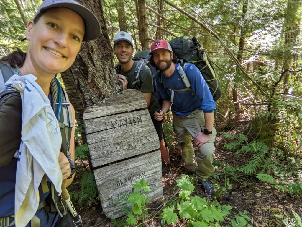
We got to the junction of the Castle Pass Trail and were pleasantly surprised to see that it was well maintained and easy to follow. We laughed at our hesitation to hike this trail and gloated at our good fortune. As we hiked, a few blowdowns appeared on the trail, but we were unfazed. We soon exited the National Park and entered the Pasayten Wilderness and found a little campsite next to a stream right before the trail headed uphill. We scarfed down our dinners and started peering into our food bags hungrily. The food would need to last another 5 days.
Entering Pasayten Wilderness.
“There are so many snacks in here, but I can’t eat any of them! This sucks!” Donner said, voicing what each of us were silently thinking. Almost a week into our trip, and hiker hunger had finally kicked in.
We crawled into our tents hungry.
Looking at the map, I noted that the stream we were camped by was called Three Fools Creek, located just below Three Fools Mountain. Was the landscape trying to tell us something?
Studying the map. We are camped next to Three Fools Creek… *snort*
Day 6:
As usual, we got up early for the climb. It was a 4,000ft climb, and beyond that we had another 15 or more miles of this mysterious unmaintained trail ahead of us. The climb happened in less than 4 miles. Our calves burning from the steep trail, we were happy it was easy to follow and fairly well maintained. I was happy to see the crest of the pass, but where the trail got to the top, it kind of just petered out. We spent a few minutes admiring the landscape and pondering our next move, studying the map, and decided to simply make our own route following where we thought the trail should theoretically be. We walked along the side of the ridge – based on what the map suggested – but because the terrain was steep, and our feet were constantly at an angle along with the mountain. After a mile or two, the trail magically reappeared, and we tentatively followed it before it petered out again. Then we saw some pink flagging on a branch and walked over to it. From there we saw some more pink flagging. It was clear that someone had come through here at some point and attempted to flag the trail.
Part of the ridge
Some trampled vegetation and bear poop suggested that people may not have been the main users of this “trail.” As we got a view down into the valley we were headed into, we were only slightly surprised to see a bear right where we were supposed to be heading. We followed the flagging down where the bushes and herbaceous plants grew thicker and thicker, and eventually we realized that we were almost on top of the bear.
Still appreciating the scenery
So beautiful!
We shouted at it, but it didn’t even bother to look at us. Any self-respecting bear on the East Coast would have high-tailed it out of there by now, and we were shocked that this black bear had absolutely no fear. I guess hunters never came out this far. How could they? Plus, this could easily be a National Park bear, where hunting is not allowed. We inched closer to the bear, grouped up and shouted at it some more. The bear looked at us and sized us up. “Uhhh… hi bear…” I said nervously, taking a step backwards onto John’s toe. I was having second thoughts about trying to pass him. Finally, however, he pretended to be slightly more interested in a shrub a bit further away from us, and we were able to sneak past, but that was not the type of bear encounter I was used to. At least he showed no signs of aggression. Just no fear either.
Hi bear…
Moments later, an abrupt clapping sound came out of the bushes, scaring the crap out of us. Our hearts raced. It was a grouse.
The trail sucked. It basically didn’t exist beyond the imagination of a bear. We kept rolling our ankles, wading through plants above head height unable to see our feet. Occasionally when we would see the ground there was bear poop. We were obviously walking his normal commute.
Bear commute
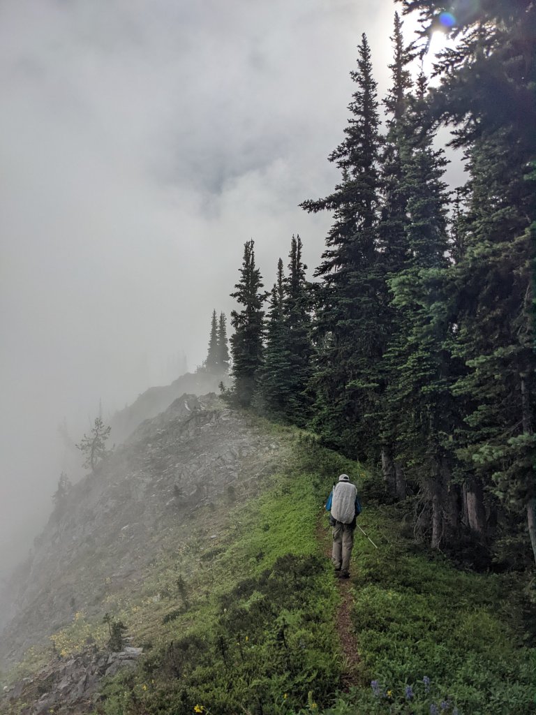
Luckily the heat wave of the last few days had ended in a somewhat drizzly day, and while the cooler weather was a welcome change, we were soaked from head to toe from plowing through wet vegetation all day. While Donner was clearly miserable, John seemed to be enjoying the adventure. Castle Pass Trail certainly had some great views and offered a level of adventure that a well-groomed trail like the PCT could never provide.
Still smilingGorgeous mountains as far as the eye can see
Snow!
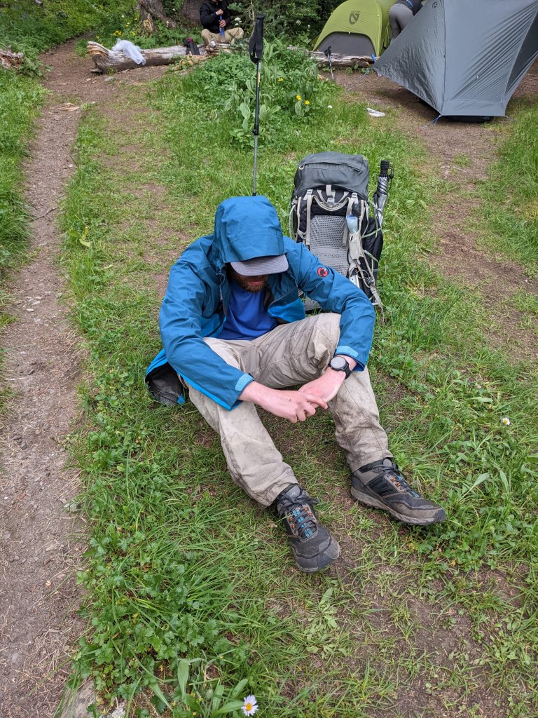
Eventually, however, we arrived wet, hungry, tired, and covered in scrapes and bruises to the PCT. Where the Castle Pass Trail intersected the PCT, someone had hung a clothesline over the Castle Pass Trail. There was barely a trail, and certainly no sign or other clue to suggest that people actually traveled this way, so it was quite amusing to have to duck under someone’s wet clothes to step foot on the PCT again. There were several people nearby swatting mosquitoes and making camp. They were oblivious to our entrance. We sat in the middle of the trail feeling sorry for ourselves. John was in a daze, and Donner had his head between his knees, and I kind of wondered if he was crying. I pulled out a snickers bar to share with my group to lift our spirits. After some debate we decided it was worth trying to push further towards the Canadian Border on the PCT since where we were was crowded and buggy.
Clothes line over the Castle Pass Trail
Donner is pooped
John looking a little worst for wear
Once we filled up on water, we could potentially camp anywhere we wanted, but in the dense Washington forest, there were no camping options. The trail was a highway. For the first time since we left Ross Lake, we could walk 3 miles an hour, and there were people every couple of minutes passing us. Quite a change from the abandoned trail we had just come from.
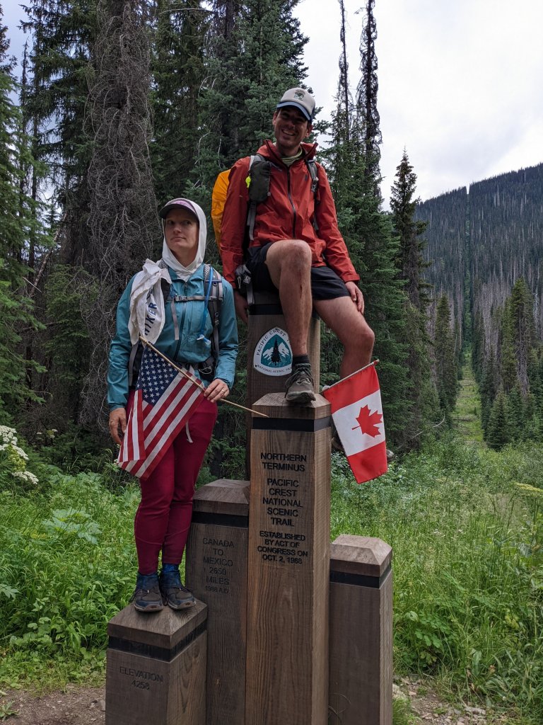
Soon we found ourselves at the Canadian border, at the PCT monument we failed to reach during our thru-hike in 2014 because the snow was too high. We spent a moment getting some pictures while swatting mosquitos. Miraculously we also found a tiny camp spot right near the border. While it was still buggy, there was nobody else there, and we could go to sleep early. The temperature quickly dropped, and I snuggled into my sleeping bag, a nice change.
I got to pee in Canada!
A little moment of glory at the northern terminus of the PCT
Day 7:
In the morning, Donner’s thermometer read 31F. From 110F to below freezing in less than a week – crazy. We started Southbound on the PCT and passed hikers all day long. There are double as many hikers on this section of the PCT compared to any other section of the trail because every hiker here has to do an out-and-back to the Canadian border because of COVID. In previous years, you may have been able to hike into Canada and exit the trail there. That is no longer allowed, at least for now.
We bumped into a trail maintainer with a cross-cut saw and thanked him profusely for the work that he was doing. Since we were hiking in a Wilderness area, no chainsaws or other motorized equipment is allowed. They have to do all the trail maintenance the old-fashioned way. We vowed never to take a maintained trail for granted ever again, and also told him that if he had a spare month, there was a 19-mile project called the Castle Pass Trail. He told us that it had been years since they have been able to clear any trail besides the PCT. It’s too bad. If we had the time, we would have loved to volunteer.
Lupines, mountains and Donner
My ankle, my hip and my shoulder all hurt. I eventually started complaining about it out loud and found out that all three of us had sore ankles, and in almost the exact same way. Something on the inside of our ankles had gotten wrecked by the Castle Pass Trail.
Lupines are Donner’s favorite flower
Luckily the scenery was gorgeous, and the trail was easy. We passed boulder fields and saw our adorable friends the pikas – a cute alpine rodent that looks like a chinchilla without the tail. And finally, we got a view of Three Fools Mountain, and had to get a picture of us three fools in front of it. There was something about that moment– the three of us, exhilarated by the adventure, with matching injuries, goofing off in front of these daring mountains– it was just intoxicating. This is what life is all about.
Three Fools, the mountain plus Three Fools the hikers.
Day 8:
It was cold again at night, but the cool evening temperatures seem to ward off the mosquitoes in the early morning. By lunch time we were at Hart’s Pass and found a picnic table to eat at. We watched as Northbound thru-hikers set up shop to start hitchhiking off the trail. This was it; they were done. They seemed done. They were so excited to stop hiking. None of them seemed sad to be finished, they all seemed ready for it. The three of us looked at each other, knowingly. They had no idea.
At the end of your first thru hike, there is a huge sense of accomplishment that comes with finishing a long distance trail. But the glory wares off, and reality sets in. No more adventure. “Real life”. Work. Money. The future. It’s really hard to adjust. These innocent thru-hikers had no idea that this is the end of something magical, and they’ll miss it for the rest of their lives.
Lunch consisted of tortillas with tuna from a foil packet or peanut butter. We kept hiking and there was a long hot stretch without water. I felt nauseous. Was it the heat or the tuna? I burped about 50 times and eventually started to feel better. I think it was the tuna.
Peanut butter on a tortilla. Who needs a utensil when you’ve got a perfectly good finger that hasn’t been washed in 9 days?
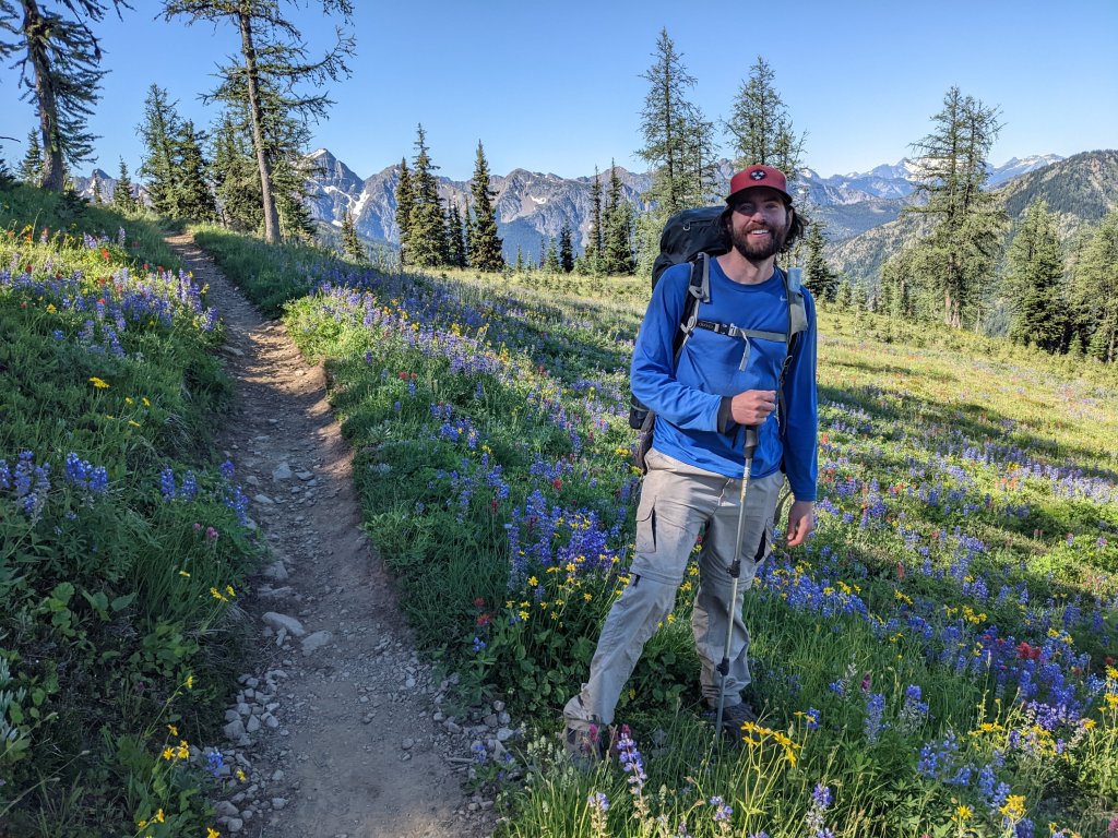
The trees along the ridge were mostly larches, and John was very excited, taking many pictures of them and announcing that larches were his favorite trees. I tried to imagine how many people knew what larches were. Probably not many. We hit a small patch of snow and decided to make ice packs using ziplock bags to try to help with our sore ankles. We will have matching injuries.
Day 9:
First thing in the morning, we passed a tall lanky German hiker who seemed very upset. “Is the trail overgrown all the way up the mountain?” He whined.
“No?” We all answered looking down at the trail trying to figure out what he meant. “Well, you will have an adventure for the next half mile or so.” He replied.
We wandered down the trail laughing at how spoilt PCT hikers are, and how unacceptable they find overgrown trail. In his defense, the trail was *slightly* overgrown, but nothing compared to Castle Pass, or even Park Creek Pass or Panther Creek Trail for that matter. God forbid you have to touch some vegetation.
Next up, we got talking to some German ladies (there seem to be a lot of Germans on the PCT), one of whom had blisters after walking from Hart’s Pass. They were hoping to hike all the way to Steven’s Pass (more than 120 miles south). Uli (one of the ladies) was upset that she couldn’t get any cell phone service since she could otherwise get her husband to meet her at Route 20 with her trail runners and send him home with her uncomfortable hiking boots. Donner had brought a nifty new satellite gizmo (the InReach Mini), which can send text messages by satellite for something like $0.50 per message and decided to offer her the service. We set the instrument on a rock and let it connect to the satellites while Uli tried to type a message in under 170 characters to her husband. The message sent out, and the ladies hiked ahead while we stopped to collect water and have a snack. A few minutes later a series of 4 messages came back.
“Altas?”
“Altras? “Columbias?”
“I don’t know which ones are your trail runners”
Shoot. Each one of these messages was costing Donner, and the husband on the other end had no idea he was communicating with an expensive Satellite device and not an ordinary cell phone with infinite bandwidth. Donner sent a reply, just guessing about the shoes at this point.
“Altras, and please no replies.” Then he turned the device off.
We caught up with the ladies and verified that the shoes she wanted were indeed the Altras. We had guessed correctly. Phew.
German ladies trying to send out a message
Moments later Uli stopped and said, “We should probably collect water, I have only a liter left.”
“But there’s no water here…?” John remarked.
“We should have collected where you did, there’s never water when we want it.” Uli replied. “When we started, we carried 7 liters of water!”
I was shocked. Seven liters of water weighs 14 pounds. My whole backpack including food and water was probably only a few pounds heavier than that.
“Are you carrying a map?” I asked. She nodded.
“The blue lines on the map indicate streams, and when the trail crosses them, you will find water,” I said trying not to sound too condescending.
“It doesn’t always work out that way,” she argued.
I blinked, not really knowing what to say. Again, trying not to make her feel stupid I added, “we have found water at every stream on the map, and then there have been some small creeks that are not on the map because the snow is still melting.”
We left them to figure out their water situation, and continued hiking, gossiping about how unprepared these women were. Moments later a small creek appeared, and we knew they would be fine. Most of the PCT in Washington has plentiful water. Had they been hiking further south on the PCT, they may have been in bigger danger.
A rare patch of snow near Cutthroat Pass
We set up camp next to Porcupine Creek with only a few miles left to get to Route 20, and as we munched on whatever was leftover in our food bags, the German ladies passed us trying to meet Uli’s husband before nightfall.
I was excited at the prospect of town. After 10 days without a shower, we were filthy. We also hadn’t had a hot meal in as many days. A burger sounded fantastic. I fell asleep imagining curling up under clean sheets in an airconditioned hotel room, having taken a long shower.
Day 10:
I woke up as excited as I fell asleep, and I powered down the hill towards the road. John and Donner were slower to get going, and for a change I was hiking ahead of them. I passed a couple out on a day hike and decided to entertain myself by sending a message back to confuse John. “Ask the really tall guy wearing shorts if he likes larches” I said to them. I explained that it would be funny.
When Donner and John caught up with me at the parking lot, I asked John if the couple asked him any questions. Donner cracked up. “They asked ME if I liked larches, and I was so confused!” he said.
“You’re not that tall, and you’re not even wearing shorts,” I laughed.
“They asked me too!” said John. “They were like ‘I hope you’re the right person to ask this question to – do you like larches?’”
“And — what did you tell them?” I asked
“I told them it was my favorite tree.” We all laughed, but I was probably the most amused.
The next task was to hitchhike into town. It was already getting warm, and there was no shade on the road. Plus, there were three of us and people driving by may not want to pick up three hitchhikers all at once. We decided to try anyway. We stuck out our thumbs and put smiles on our faces as one car passed every 20 minutes. It was hopeless. There were ten times as many cars going toward Seattle as there were going towards Winthrop, the town we were aiming for. We decided to try taking turns, letting either me and John try, or Donner by himself.
While Donner was waiting in the parking lot, a couple of hikers walked into the parking lot and started loading up their vehicle. He ran up to talk to them, and eventually waved us over. I ran over, excited that we had probably gotten a ride.
“Who’s up for another hike?” Donner said, cheerfully.
John didn’t wait for my answer, knowing how disappointed I probably was. “MEEEEE!” he shouted.
The couple were headed to Winthrop, but by way of Blue Lake, a popular 4-mile hike. It was our best shot at getting a ride to town. We hopped in.
Although I was not mentally prepared to hike another 4 miles, the destination was beautiful although a bit crowded. We even saw mountain goats along the way, who seemed less phased than I was by the number of people.
Blue Lake
Crappy picture of some mountain goats
We eventually got dropped off in Winthrop, where we wandered into the hostel we booked, and I enjoyed possibly the most satisfying shower of my life. After we were all cleaned up, we wandered back into the broiling heat to find a burger at the Old School House brewery. We probably would have stayed and ordered more food after we polished off our burgers, but our outdoor table was slowly moving into full sun, and we were melting in the heat. Instead, we opted to find ice-cream somewhere else.
Everything in Winthrop was exorbitantly expensive. A single granola bar was almost $2, a single string cheese was $1, and a small jar of peanut butter was $6. I was so glad I mailed another resupply package to the hostel we stayed at.
Eventually, I got my dream of crawling into a freshly made bed with the air-conditioning cranked all the way up.
It’s been a while since I’ve blogged about any of our hiking adventures. I completely lost steam as I entered grad school over a year ago now. In case you’re wondering, I’m working on getting a Master of Forestry degree from Duke University. I gave up a perfectly good career as a hiking bum to do this, so it better be worth it.
“Write a blog and I’ll read it,” my parents said. So here I am.
This summer, as has become somewhat of an annual tradition at this point, John and I decided to do a ~200 mile loop with our friend Donner (whom we met on the AT 12 years ago now) somewhere out West during the heat of the summer here in the Southeast to avoid the muggy 90-100 degree days.
Day 1:
After landing in Seattle, we met up with Donner and made our way to Stehekin, where it was almost 110 degrees. What the heck.
Getting from the airport took more hours of planning than executing, and involved a one way rental car followed by a bus followed by a ferry down Lake Chelan to Stehekin where we got a shuttle to the trailhead. We did all that in one day and even hiked 5 miles at the end of it, feeling completely jet lagged. In Stehekin we made the wise decision to jump into Lake Chelan as the nausea from heat exhaustion was taking hold.
The shuttle to the trailhead stopped at the Stehekin bakery, something we remembered from our thru-hike of the PCT 8 years ago. Our shuttle was full of boisterous thru-hikers. Our loop would include the PCT, but we would quickly veer off to hike part of the alternate route we took during our SOBO thru-hike so as to complete the loop.
Day 2:
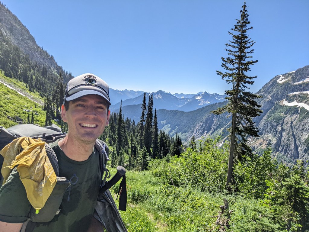
We decided to take advantage of our jet-lag and wake up before the crack of dawn and get some miles in during the cool morning hours. The 100-110 degree weather was supposed to persist for a couple of days before cooling down to a balmy 90-something degrees. Because we were hiking in North Cascades National Park, we had to reserve our campsites for the first 4 or 5 nights before we left the park for Forest Service land, where we could camp wherever we pleased. Luckily we had planned a few easy days to start out so that we could “warm up.” The first day involved climbing from barely 1000ft above sea level over Park Creek Pass, which brought us up over 6000ft where we could hang out during the heat of the day. Higher elevations offer cooler temperatures.
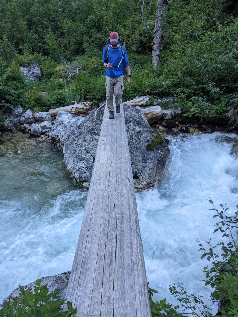
Would you be able to cross?
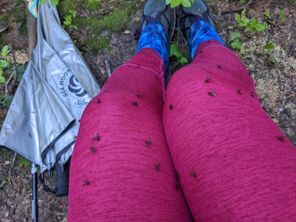
As we climbed up the valley, it was already too warm. The sun beat down on us, and I huffed and puffed through overgrown trail trying to keep up with the guys. I was having an asthma attack. I couldn’t catch my breath, and my breathing sounded awful. I puffed on my emergency inhaler and tried to continue since there were swarms of flies the size of house flies landing on us and generally annoying the crap out of us. The wheezing continued. I stopped again. “Sorry guys…” I said, putting my head between my knees. The flies landed on us by the hundred, but they were slow, and kind of fun to kill. John and Donner spent a few minutes trying to see how many they could squish at once while I tried to breathe more slowly.
Flies
Park Creek Pass
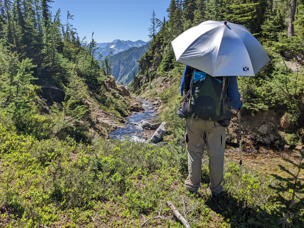
Umbrella for shade
Snow on Park Creek Pass
We continued upward, and while the flies were still annoying us, we were soon introduced to a swarm, or a wave, or maybe a typhoon of caterpillars. I don’t know what the right word is for millions upon millions of caterpillars, but the result on the landscape was horrific. The entire hillside was defoliated, and in the middle of the trail, where we were walking on what looked like clumpy dirt was actually an entire layer of deceased caterpillars. It was disgusting. The trail was still somewhat overgrown, and every bit of defoliated twig or branch overhanging the trail was covered in caterpillars. When we brushed up against the vegetation, caterpillars often stuck to our legs, socks, shoes, and shoelaces. When the vegetation was higher, we got caterpillars on our shirts, backpacks and even occasionally in our hair. We later found out that these were Western Tent Caterpillars, and indeed there are outbreaks of these creatures roughly every 10 years. The resulting defoliation can be seen from low flying aircraft.
Western Tent Caterpillar
Defoliation and caterpillar tents
We reached the pass and found a large patch of snow to play on. This snow was much more welcoming compared to the snow we found here a month earlier 8 years ago where we had to wear microspikes and use our ice axes to keep from falling thousands of feet. In fact, that experience left such a huge impression on us that John decided to carry two pairs of microspikes during this trip in case we encountered any scary snow.
We found the shade of some rocks with a slight breeze to hang out in for a few hours, murdering a few flies every now and then when the wind died down, and caught up on life with Donner.
Snacking in the shade of some rocks
The other side of the pass was much more pleasant – not overgrown, no caterpillars, and I even felt like the flies were a little less persistent. It felt like a long way down to camp, but when we got there it was still too hot.
Day 3:
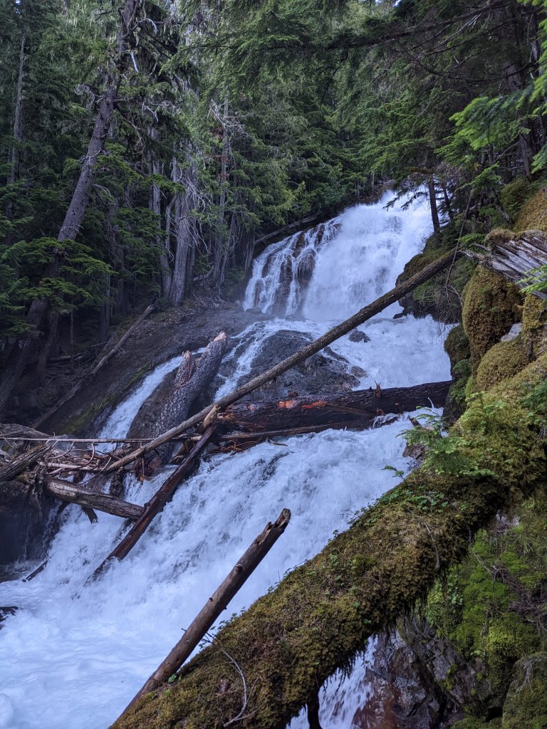
In the morning John showed us a waterfall near where he collected water the night before. There’s a reason this park is called Cascade National Park. I’m sure many of the waterfalls we saw on this trip have no name. We hadn’t seen a single other hiker after leaving the PCT yesterday morning, so we were very surprised to run into a Park Ranger. We chatted with her for a few minutes, and showed her our permit. I should have taken this as a hint that as we were walking towards Route 20 there would be a few more people on the trail. But I gave it no thought, and decided to pee right next to the trail just as a trail runner came zipping down the trail next to me. Oops! Luckily I’ll never see him again. I hope.
Snacking by a stream
Nice trail
As the day wore on, the heat became unbearable, and every time we came to a stream we took off our shirts and our hats and soaked them in water before putting them back on again. Staying wet was the only way to stay cool. Since we had another short day, we also rested next to streams, where the glacial water helped cool down the air directly around the stream. We had another pass to climb today: 4th of July Pass, and we waited until the evening to brave the climb, hoping it would be just a little bit cooler, and the sun would be just a little less intense. I was happy when I didn’t get an asthma attack going up 4th of July pass, and felt really good about that. At the top I found a lovely two bedroom (two flat spots), one bathroom (tree) camping spot with a living room (logs to sit on) and a sun room (sunny spot) for drying our shirts out, but John and Donner decided it was a little too dusty there when the wind blew, so we found a slightly smaller set of accommodations a few feet away amongst the rocks.
Campsite with a view
Day 4:
We packed up while watching the sun rise and the hiked down Panther Creek. They had cut back some of the vegetation, which was nice, as this section of trail obviously is prone to being very overgrown. We passed an established campsite where we were all able to use the toilet. Toilets in these primitive campsites consist of a hole in the ground with a wooden toilet seat to sit on, and no walls. You have to sort of shout down the privy trail to ask if someone is there so that you don’t just walk up on them. Near the toilet there was a beautiful waterfall where I think there was a huge snow bridge when we came through here 8 years ago.
I think there was a snow bridge here 8 years ago…
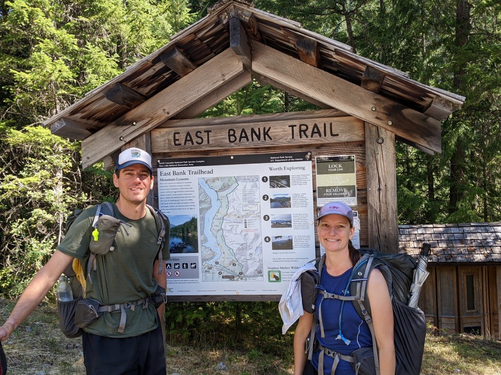
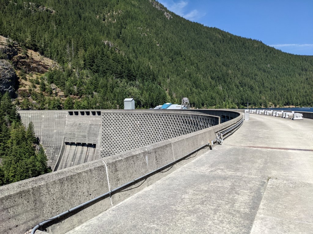
Dam
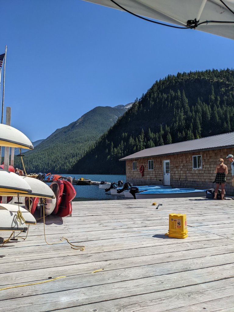
We had an annoying PUD (pointless up and down) before arriving at Route 20. There was an amazingly well maintained trail just downhill from the highway that clearly very few people walk on that we were able to take to get to Ross Lake. We walked over the dam at the base of the lake and wandered over to Ross Lake Resort, where we had sent a resupply package. This resort was not what I had pictured in my mind when we decided to use this spot as a resupply, but I wasn’t complaining. The resort consisted of a series of buildings that were floating on top of the lake on wooden platforms, only accessible by boat or by trail. I was annoyed that it cost us $20 per box (we had two boxes) to pick up our packages, but the lady explained the hassle involved in getting these boxes to the resort. “Someone has to pick them up at our PO box, drive them to Chelan, load them on the boat, and then offload them here. You have no idea how many hands these boxes have to go through.” The lady said, taking our credit card.
Ross Lake Resort floating on the lake
We were surprised to find a soda machine with $1 sodas floating around next to one of the buildings (how do they get these here?), so we indulged before heading out on an expensive water taxi to the other side of the lake where we would be dropped off at a point along the East Bank Trail to continue our loop. We could have walked there, but it would have added at least 10 miles, most of which would be repeated miles, to a section that was already 100 miles long without a resupply option. Paying money to cut back on miles feels a little weird from a hiker’s prospective, but such is life.
We walked a few more miles to camp at Roland Creek where it was still too hot. Some mosquitoes decided to come out and chase us into our tent.


 Gorgeous mountains as far as the eye can see